
Titlu prioect: Sensing, mapping, inteconecting: tools for soil functions and services valuation
Acronim: SOILSERV
Contractul de finanțare nr. 760104/23.05.2023, cod CF 245/29.11.2022
Director de proiect: Paulo PEREIRA
Durata: 36 luni
Perioada implementare: 01.07.2023 – 30.06.2026
Abstract (EN):
Soil microbiota (SB) is recognized as Earth’s biological engine that are indispensable to sustain vital ecosystem processes (SES) and for maintaining soil functions (SF) but pressures of global change, it is expected a potential alteration. SOILSERV has in concept to combine remote sensing (SENSING) and spatial modelling (MODELLING) with new approaches for soil microbiota abundance (lipidomics) and functionality assessment (metabolomics) with aim to link disparate soil functions, mediated by soil microbiome, to ecosystem services goods and components (INTERCONNECTING). The use of these tools, allows to SOILSERV a contiguous MAPPING, by ‘filling the gaps’ between in situ phenotypic structure abundance of field samples and potential ecosystem services delivering. SOILSERV will combine soil microbiota phenotypic structure abundance data covering 5 geoclimatic regions from Romania (Continental, Black Sea, Pannonian, Steppe and Alpine sites) with synoptic environmental parameter data predicted from remote sensing satellite image models (SIM). This will be enlarged with MAP (Microbial Assemblage Prediction) and PRMT (Predicted relative Metabolic Turnover) approaches, where: 1.) MAP facilitate to predict microbial community phenotypic structure and abundance as a function of SIM data by creating a Bayesian co-dependency network of used lipidomic markers to express microbial phenotypes; and 2.) PRMT, a translation tool that uses the changing relative abundance of functional lipidomic markers, and that of metabolic and co-metabolic products between samples to predict the changing capacity of the community to consume or generate metabolites. The generated outcome is a system-scale model of microbiota phenotypes and metabolism as a function of environmental properties that were estimated from remotely sensed satellite images SIM allowing thus soil microbiome functioning qualitative and quantitative assessment, and its connection with delivered soil services.
Abstract (RO):
Microbiota solului este indispensabila pentru susținerea proceselor vitale ale ecosistemului și menținerea funcțiilor solului fiind estimata o potențială alterare din cauza presiunilor schimbărilor globale. SOILSERV propune combinarea teledetecției (SENSING) și modelarii spațiale (MODELLING) cu noi abordări pentru evaluarea abundenței microbiotei solului (lipidomică) și a funcționalității acesteia (metabolomică), cu scopul corelarii funcțiile disparate ale solului, mediate de microbiota, cu serviciile ecosistemice (IINTERCONNECTING). Utilizarea acestor instrumente permite o cartografiere (MAPPING) adiacentă, prin „umplerea golurilor” dintre abundența structurii fenotipice in situ a probelor de teren și serviciile ecosistemice potențial furnizate. SOILSERV va combina datele de abundență a structurii fenotipice a microbiotei solului pentru 5 regiuni geoclimatice din România (situri continentale, pontică, panonică, stepă, alpina) cu datele sinoptice ale parametrilor de mediu obtinute din modele de imagini satelitare prin teledetecție (SIM). Datele vor fi completate cu abordări MAP (Microbial Assemblage Prediction) și PRMT (Predicted Relative Metabolic Turnover), unde: MAP facilitează prezicerea structurii și abundenței fenotipice a comunității microbiene, funcție de datele SIM, prin crearea unei rețele de codependență bayesiană a markerilor lipidomici folosiți pentru exprimarea fenotipurilor microbiene iar PRMT, instrument convertor utilizand abundența relativă în schimbare a markerilor lipidomici funcționali și cea a produselor metabolice și co-metabolice dintre probe, poate prezice capacitatea în schimbare a comunității/consumul/generarea de metaboliți. SOILSERV va furniza un model la nivelul sistemului fenotipurilor și metabolismului microbiotei corelat cu proprietățile de mediu estimate din imagini satelitare prin detectia SIM, permițând evaluarea calitativă și cantitativă a funcționării microbiomului solului și conexiunii sale cu serviciile de sol furnizate.
Stage 1
The main activity of this stage was the start of the assessment of the Alpine biogeographical region. The following tasks were performed to achieve this significant goal: physico-chemical indicators selection and assessment to describe the properties of soil samples in the Alpine biogeographical region; identification and evaluation of anthropogenic pollution indicators in soil based on field observations; selection of meteorological parameters to determine the inventory of pressures caused by climate change; identification and assessment of indicators for soil microbiota abundance, structure and functioning; selection of proximal and remote sensing indices to assess soil ecosystem services
Results achieved
- Sampling procedure established
- Sampling plots in the Alpine biogeographical region selected
- Sampling points for each plot established
- Selected physico-chemical indicators
- Indicators for anthropogenic pollution based on field observations, selected
- Selected meteorological parameters
- Indicators for soil microbiota assessment selected
- Proximal and remote sensing indices for assessing soil ecosystem services selected
Stage 2
The activities carried out in this stage consisted in: selection for study of the plots in the continental biogeographical region; characterisation of soils collected from the Fan-Alpine biogeographical region; extension of the indicators related to the soil microbiome (lipidomics) established in the first stage, as soil microorganisms are key players in the multiple soil functions and related ecosystem services. In order to achieve all the objectives proposed in stage 2, environmental samples were collected from the continental biogeographical region. The soil properties characterisation plan was similarly established like in the Alpin area. For the Fan area, soil sample properties were assessed to establish the inventory of anthropogenic pressure; meteorological data were collected from available meteorological stations to make the inventory of climate change pressures; soil microbiota abundance, structure and function were assessed.
Results achieved
- Plots selected in the continental biogeographical region for the study proposed by the project
- Physicochemical properties of soils collected from the Fan plot, Alpine biogeographical region (as defined in the work plan)
- Inventory of anthropogenic pressures for the Fan plot in the Alpine biogeographical region
- Meteorological parameters collected during the sampling period for the Alpine biogeographical region
- Maps of spatial distribution of soil microbiome abundance in the Fan zone, Alpine biogeographical region
- Membrane lipid fractions of the soil microbiome in the Fan area, Alpine biogeographical region
- Microbial abundance and phenotypic structure of soil microbiota in the Fan zone (Alpine biogeographical region)
- Indicators of soil functions mediated by microbiota
Stage 3
The activities carried out had the following objectives: selection of plots for study in the Pannonian biogeographical region, characterization of soils collected from this region, and extension of indicators related to the soil microbiome (lipidomics, metabolomics) as they are key actors in the multiple soil functions and related ecosystem services. After soil sampling in the Pannonian biogeographical region, the properties of the sampled soils were assessed based on the parameters and methods established in the previous stages. The data obtained (laboratory analyses) become the basis for mapping the monitored parameters for the Pannonian biogeographical region. Different gas chromatographic techniques and analytical methods were used to fractionate microbial membrane lipids and determine microbial primary and secondary metabolites.
Results achieved
- Coordinates of sampling points for each plot in the Pannonian biogeographical region
- Physicochemical properties of soils collected from the study plots, Pannonian biogeographical region
- Inventory of anthropogenic pressures for the Pannonian biogeographical area
- Data processing (statistical analysis) for the spatial distribution maps of soil microbiome abundance and of soil properties for the Pannonian biogeographical region
- Abundance and phenotypic structure of soil microbiota in the Pannonian biogeographical region
- Spatial data collected, Google Earth images, for each field studied
Etapa 4
In aceasta etapa, activitatile desfasurate au fost legate de selectarea parcelelor de studiu in regiunea biogeografica stepica si de caracterizarea solurilor colectate din parcela agricola din regiunea biogeografica Continental. O activitate cheie a acestei etape a constat in extinderea indicatorilor legati de microbiomul solului: lipidomica – identificarea si profilarea macrolipidelor. Macrolipidele au fost identificate pentru probele de sol colectate din padure din regiunea biogeografica Panonic. O alta activitate importanta a acestei etape a fost identificarea cailor de degradare a unui compus organoclorurat persistent identificat in probele de sol din regiunea Alpin. Subprodusele de degradare au fost identificate in probele de sol colectate din parcela Fan, regiunea biogeografica Alpin.
Rezultate obtinute
- Coordonatele punctelor de esantionare pentru parcelele din regiunea biogeografica Stepa
- Proprietati fizico-chimice ale solurilor studiate din regiunea biogeografica Continental
- Inventarul presiunilor antropice pentru regiunea biogeografica Continental (teren agricol)
- Cartografierea parametrilor monitorizati pentru regiunea biogeografica Panonica
- Extinderea indicatorilor microbiotei solului prin fractionarea extinsa a lipidelor
- Abundenta si structura fenotipica a microbiotei din regiunea biogeografica Continental
- Date spatiale colectate
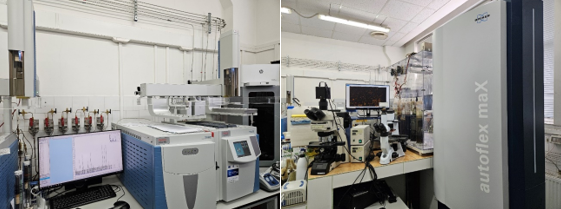
Foto: Laboratorul de “Biodiversitate a solului” unde se desfasoara studiul microbiotei solului
Etapa 5
In aceasta etapa, activitatile desfasurate au fost legate de identificarea presiunii antropice asupra solurilor colectate din parcelele de pasuni din regiunea biogeografica Continental. De asemenea, au fost elaborate harti ale distributiei contaminantilor identificati in parcelele de pasuni studiate. Au fost identificate fractiuni lipidice (fosfolipide, lipide neutre, glicolipide), molecule macrolipidice si metaboliti (primari, secundari) pentru probe de sol colectate de pe pasune. Au fost realizate harti ale distributiei abundentei structurii fenotipice a microbiomului din sol.
Rezultate obtinute
- Cartografierea parametrilor monitorizati pentru regiunea biogeografica Continental, tip utilizare teren: pasunat
- Extinderea indicatorilor microbiotei solului prin fractionarea extinsa a lipidelor
- Evaluarea functiilor solului mediate de microbiota solului (activitate enzimatica)
- Harta distributiei abundentei microbiomei solului in pasunile studiate, regiunea biogeografica continentala
Etapa 6
In aceasta etapa, activitatile desfasurate au fost legate de evaluarea proprietatilor solului si de identificarea presiunii antropice potentiale asupra solurilor colectate din parcelele de pasuni si arbusti din regiunea biogeografica pontica. Abundenta structurii fenotipice a microbiomului solului a fost identificata in parcelele studiate. Activitatea ureazei a fost evaluata deoarece aceasta este o enzima esentiala in ciclul N. Analizele efectuate au evidentiat legaturi intre structura comunitatii microbiene si ciclul N in ecosistemele pedologice din regiunea biogeografica pontica. Rezultatele obtinute in cadrul fazei au fost utilizate pentru elaborarea unor harti ale distributiei implicarii microbiomului solului in ciclul azotului, in solurile agricole si arbustive studiate din regiunea biogeografica pontica.
Rezultate obtinute
- Proprietati fizico-chimice ale solurilor studiate din regiunea biogeografica Pontica (teren agricol si tufaris)
- Inventarul presiunilor antropice pentru regiunea biogeografica Pontica (teren agricol si tufaris)
- Abundenta si structura fenotipica a microbiotei din regiunea Pontica (teren agricol si tufaris)
- Harti distributie microbiota solului din regiunea Pontica (teren agricol si tufaris)
- Coeficienti statistici MAP-PRMT
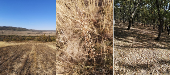
Foto: Imagini cu punctele de prelevare a probelor din regiunea biogeografica Stepica
Etapa 7
In aceasta etapa, activitatile desfasurate (cu exceptia celor legate de gestionarea financiara si tehnica a proiectului) au fost asociate cu evaluarea proprietatilor solului si identificarea presiunii antropice potentiale asupra solurilor colectate de pe parcelele de padure si pasuni din regiunea biogeografica pontica. In aceste parcele studiate a fost identificata abundenta structurii fenotipice a microbiomului solului. Coeficientii de corelatie pentru MAP-PRMT au fost stabiliti pe baza plierii lipidelor. Au fost elaborate harti ale distributiei implicarii microbiomului solului in ciclul C in solurile de padure si de pasune studiate din regiunea biogeografica pontica.
Rezultate obtinute:
- Proprietati fizico-chimice ale solurilor studiate din regiunea biogeografica Pontica (teren forestier si pasune)
- Inventarul presiunilor antropice pentru regiunea biogeografica Pontica (teren forestier si pasune)
- Abundenta si structura fenotipica a microbiotei din regiunea Pontica (teren forestier si pasune)
- Harti ale distributiei microbiotei solului din regiunea Pontica (teren forestier si pasune)
- Coeficienti statistici MAP-PRMT
Etapa 8
In aceasta etapa, activitatile desfasurate au fost legate de evaluarea proprietatilor solului si de identificarea presiunii antropice potentiale asupra solurilor colectate din parcelele de teren agricol si teren forestier din regiunea biogeografica pontica. Abundenta structurii fenotipice a microbiomului solului a fost identificata in parcelele studiate. Au fost determinate activitatile enzimatice implicate in ciclul C iar rezultatele obtinute au evidentiat legaturi existente intre structura comunitatii microbiene si ciclul C in ecosistemele pedologice din regiunea biogeografica pontica. Rezultatele obtinute in cadrul fazei au fost utilizate pentru elaborarea unor harti ale distributiei implicarii microbiomului solului in ciclul C, in solurile din regiunea biogeografica pontica.
Rezultate obtinute
- Proprietati fizico-chimice ale solurilor studiate din regiunea biogeografica Pontica (teren agricol si forestier)
- Inventarul presiunilor antropice pentru regiunea biogeografica Pontica (teren agricol si forestier)
- Abundenta si structura fenotipica a microbiotei din regiunea Pontica (teren agricol si forestier)
- Harti distributie microbiota solului din regiunea Pontica (teren agricol si forestier)
- Coeficienti statistici MAP-PRMT
Etapa 9
In aceasta etapa, activitatile desfasurate au fost legate de evaluarea proprietatilor solului si de identificarea presiunii antropice potentiale asupra solurilor colectate din regiunea biogeografica continental. A fost identificata in parcelele studiate abundenta structurii fenotipice a microbiomului solului iar rezultatele obtinute au evidentiat legaturi intre structura comunitatii microbiene si ciclul C si N in ecosistemele pedologice din regiunea biogeografica continental. Rezultatele obtinute in cadrul fazei au fost utilizate pentru elaborarea unor harti ale distributiei implicarii microbiomului solului in functiile solurile din regiunea biogeografica continental.
Rezultate obtinute
- Abundenta si structura fenotipica a microbiotei din regiunea Continental
- Harti distributie microbiota solului din regiunea Continental
- Coeficienti statistici MAP-PRMT
Etapa 10
In aceasta etapa, activitatile desfasurate (cu exceptia celor legate de gestionarea financiara si tehnica a proiectului) au fost asociate cu evaluarea proprietatilor solului si identificarea presiunii antropice potentiale asupra solurilor colectate de pe parcelele de teren agricol, pasune, si forestier
din regiunea biogeografica Panonica. A fost identificata abundenta structurii fenotipice a microbiomului solului în parcelele studiate. Coeficientii de corelatie pentru MAP-PRMT au fost stabiliti pe baza plierii lipidelor. Au fost determinati coeficientii care exprima schimbarile dinamice (dependenta sezoniera) ale serviciilor ecosistemice ale solului. De asemenea, a fost determinat indicele de descompunere-prelucrare a materiei organice.
Rezultate obtinute
- Abundenta si structura fenotipica a microbiotei din regiunea Panonica
- Harti distributie microbiota solului si contaminanti antropogenic din regiunea Panonica
- Coeficientii care exprima schimbarile dinamice (dependenta sezoniera) ale serviciilor ecosistemice ale solului
- Coeficienti statistici MAP-PRMT
- Indici de descompunere-prelucrare a materiei organice